A Decade of Meteorological Progress Compressed into One Model
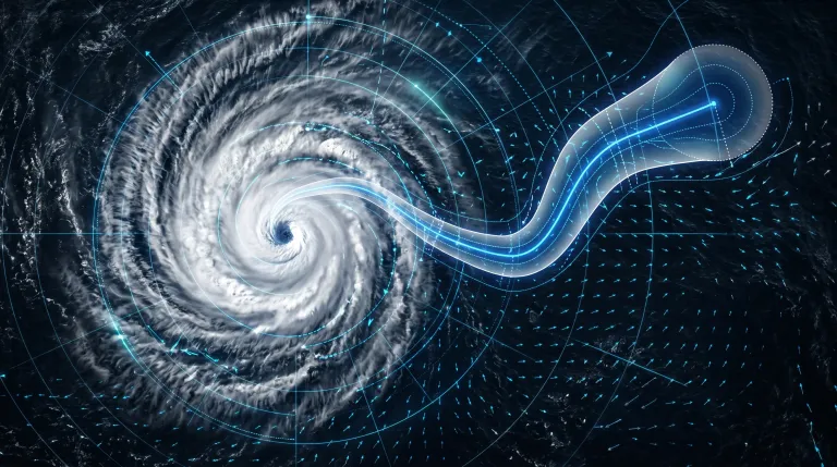
In research published on August 6, 2026 in the journal Nature, Google DeepMind and Google Research—alongside operational forecasters from the UK Met Office, the US National Hurricane Center (NHC), and the Cooperative Institute for Research in the Atmosphere (CIRA)—revealed WeatherNext. The state-of-the-art AI model tackles one of climate science's most difficult problems: accurately predicting tropical cyclone tracks, storm intensity, and wind structure simultaneously.
Tropical cyclones (also known as hurricanes or typhoons) are among the most lethal natural hazards on Earth, accounting for more than 700,000 deaths and over $1.4 trillion (approximately €1.28 trillion) in economic damages over the past 50 years. In emergency response, every hour counts. According to the peer-reviewed evaluation, WeatherNext grants forecasters an average of 24 extra hours of predictive lead time. A three-day forecast generated by WeatherNext matches the accuracy that previous state-of-the-art numerical models achieved at just two days.
Coinciding with the publication, Google DeepMind open-sourced the codebase and model weights for WeatherNext 2 and WeatherNext Cyclones on GitHub. This open-weights release enables meteorological centers, academic institutions, and independent developers across Europe and worldwide to run, verify, and adapt the system locally.
Challenging Meteorological Dogma: Unified Resolution and Lightning Speed
For decades, weather forecasting has relied on high-performance supercomputers running physical equations in numerical weather prediction (NWP) systems, such as those operated by the European Centre for Medium-Range Weather Forecasts (ECMWF). Traditional forecasting forced a structural compromise: large-scale global models tracked where a storm was heading, while separate, power-intensive regional models estimated thermodynamics and storm intensity at the eye wall.
WeatherNext eliminates this split architecture. Trained on nearly 20 terabytes of global atmospheric reanalysis data and historical storm tracks from the International Best Track Archive for Climate Stewardship (IBTrACS), the neural network models track, intensity, and wind distribution in a single unified framework.
Curiously, the model achieves state-of-the-art intensity accuracy at a spatial grid resolution of 28 kilometers—roughly 100 times coarser than the hyper-fine grids traditional physical models require. This unexpected finding challenges long-standing assumptions in computational meteorology, proving that deep learning can capture complex atmospheric thermodynamics without requiring multi-gigawatt supercomputing clusters for regional downscaling.
Speed is equally striking. WeatherNext generates a full 15-day global forecast in under 1 minute on a single Google TPU, executing eight times faster than previous-generation AI weather models. At our AI Arena benchmark testbed, where we track compute efficiency across both local and cloud architectures, this level of throughput highlights how specialized machine learning hardware can drastically reduce operational inference costs compared to legacy supercomputers.
Field-Tested in 2025: Predicting Hurricane Melissa’s Rapid Intensification
WeatherNext is not merely an academic exercise; it was battle-tested during the 2025 Atlantic hurricane season. The model assisted forecasters at the National Hurricane Center during Hurricane Melissa, successfully predicting its explosive leap from a Category 1 storm to a Category 5 super-storm and forecasting its landfall in Jamaica five days in advance. This unprecedented lead time gave disaster management teams critical days to organize mass evacuations and secure infrastructure.
Rather than relying on a single forecast line, Google DeepMind's operational setup generates 1,000 probabilistic scenarios per cyclone. By running massive ensemble simulations in minutes, forecasters can evaluate rare but catastrophic "tail-risk" events—such as sudden direction shifts or sudden pressure drops—before they manifest in real-time radar feeds.
The European Perspective: Open Weights and Sovereign Climate Resilience
The involvement of the UK Met Office and the decision to release open weights on GitHub carry substantial benefits for European weather agencies and climate tech companies. While severe tropical cyclones are most frequent in the Pacific and Atlantic, European territories—including EU outermost regions like Guadeloupe, Martinique, and Réunion—face severe cyclone threats annually. Furthermore, post-tropical transitions regularly bring extreme windstorms and flooding to continental Europe.
By providing open access to model checkpoints, European agencies such as Météo-France, Germany’s Deutscher Wetterdienst (DWD), and ECMWF member states can integrate WeatherNext weights into their existing workflows without vendor lock-in. From a regulatory perspective, open-weights deployment aligns with European open science mandates and complies with Article 50 transparency requirements under the EU AI Act, allowing public institutions to inspect, audit, and audit model behavior locally.
AI Ensemble vs. Supercomputer NWP Models
To illustrate how AI ensemble models compare to traditional supercomputer-based numerical weather prediction systems, we compiled key operational metrics below:
| Metric / Parameter | WeatherNext AI (Google DeepMind) | Traditional NWP Systems (e.g. ECMWF IFS) |
|---|---|---|
| Forecast Lead Time | +24 hours advantage (3-day forecast matches prior 2-day quality) | Baseline operational standard |
| 15-Day Compute Speed | <1 minute on 1 TPU (8× faster than prior AI models) | 1 to 3 hours on multi-node supercomputer clusters |
| Ensemble Scale | 1,000 probabilistic scenarios per storm | Typically 50 perturbation scenarios |
| Model Architecture | Unified neural network (Track + Intensity combined) | Decoupled global track & high-res regional models |
| Required Resolution | 28 km grid (100× coarser for peak intensity) | Requires <3 km fine grid for core intensity physics |
| Availability & Licensing | Open weights on GitHub (Free for research/operational adaptation) | Restricted commercial/institutional access |
Bridging AI Research and Disaster Response
As detailed in Google DeepMind's official announcement, WeatherNext features are also being integrated directly into Google's public weather services and Weather Lab platform. By combining deep learning with open-source dissemination, the project sets a new benchmark for how frontier AI labs can deliver immediate public value.
For more deep dives into frontier AI developments and open-source models across Europe, explore our analysis in the ai-jarvis.eu magazine.
Where can developers and weather agencies download the WeatherNext weights?
The code and model weights for WeatherNext 2, WeatherNext Cyclones, and a lightweight version designed for constrained hardware are publicly available on GitHub under open licenses, allowing local testing and fine-tuning.
Why is the 28 km grid resolution surprising for meteorologists?
Traditional physical weather models require grid resolutions finer than 3 km to accurately model storm intensity, consuming huge supercomputing power. WeatherNext achieves higher intensity accuracy at a much coarser 28 km resolution, demonstrating that neural networks can model complex thermodynamic interactions far more efficiently.
Does WeatherNext replace traditional meteorologists?
No. WeatherNext serves as an ensemble decision-support tool. By running 1,000 probabilistic scenarios in minutes, it provides forecasters at agencies like the UK Met Office and National Hurricane Center with clearer tail-risk probabilities to make timely public safety and evacuation calls.